Slika:Moscow satellite image.jpeg
Velikost tega predogleda: 600 × 600 točk. Druge ločljivosti: 240 × 240 točk | 480 × 480 točk | 1.000 × 1.000 točk.
Izvorna datoteka (1.000 × 1.000 točk, velikost datoteke: 396 KB, MIME-vrsta: image/jpeg)
Spodaj prikazane informacije so s tamkajšnje opisne strani.
Povzetek
| Opis |
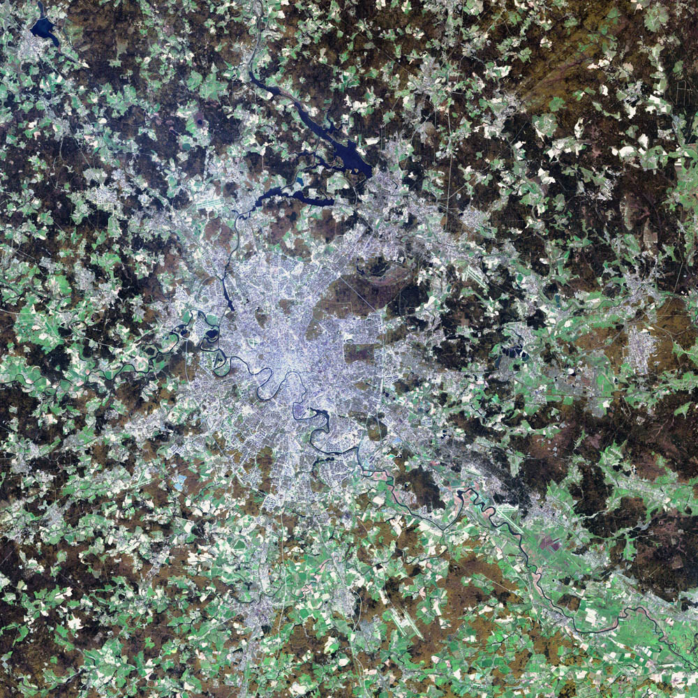
Deutsch: Satellitenbild von de:Moskau English: satellite image of the city of en:Moscow.
|
| Datum | 2. avgusta 2002 |
| Vir | NASA Visible Earth project, http://visibleearth.nasa.gov/view_rec.php?id=3434 |
| Avtor | NASA/USGS EROS Data Center Satellite Systems Branch/Landsat 7/ETM+ |
Licenca
This image is in the public domain in the United States because it only contains materials that originally came from the United States Geological Survey, an agency of the United States Department of the Interior. For more information, see the official USGS copyright policy.
|
| Ta datoteka je v javni domeni, ker jo je izdelala izključno NASA. Avtorskopravna politika NASE pravi, da »Gradivo NASE ni zaščiteno z avtorskimi pravicami, razen če je rečeno drugače.« (glej Template:PD-USGov, stran z avtorskopravno politiko NASE ali Politiko uporabe slik JPL.) | ||
 |
Opozorila:
|
Zgodovina datoteke
Kliknite datum in čas za ogled datoteke, ki je bila takrat naložena.
| Datum in čas | Sličica | Velikost | Uporabnik | Komentar | |
|---|---|---|---|---|---|
| trenutno | 07:12, 8. november 2004 | | 1.000 × 1.000 (396 KB) | Ævar Arnfjörð Bjarmason |
Uporaba datoteke
Datoteka je del naslednje 1 strani slovenske Wikipedije (strani drugih projektov niso navedene):
Globalna uporaba datoteke
To datoteko uporabljajo tudi naslednji vikiji:
- Uporaba na af.wikipedia.org
- Uporaba na ar.wikipedia.org
- Uporaba na be-tarask.wikipedia.org
- Uporaba na ca.wikipedia.org
- Uporaba na hif.wikipedia.org
- Uporaba na hr.wikipedia.org
- Uporaba na hu.wiktionary.org
- Uporaba na it.wikipedia.org
- Uporaba na kk.wikipedia.org
- Uporaba na lb.wikipedia.org
- Uporaba na my.wikipedia.org
- Uporaba na roa-tara.wikipedia.org
- Uporaba na ru.wikipedia.org
- Uporaba na sh.wikipedia.org
- Uporaba na yi.wikipedia.org