Slika:Old map of Vietnam.jpg

Izvorna datoteka (3.024 × 2.179 točk, velikost datoteke: 1,99 MB, MIME-vrsta: image/jpeg)
Spodaj prikazane informacije so s tamkajšnje opisne strani.
Povzetek
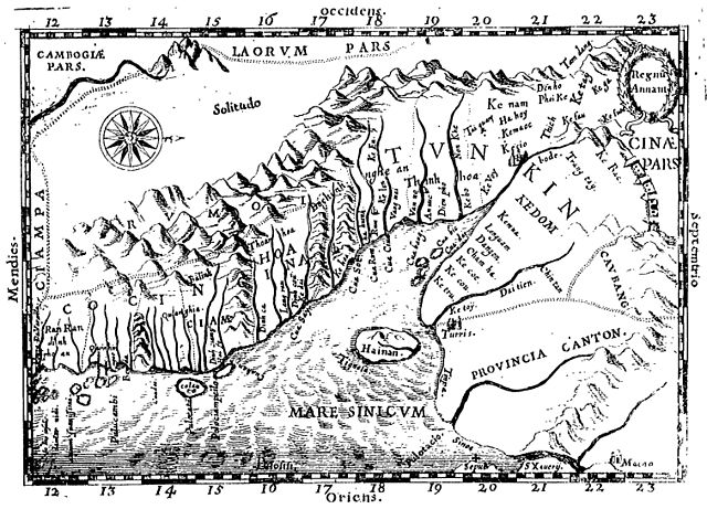
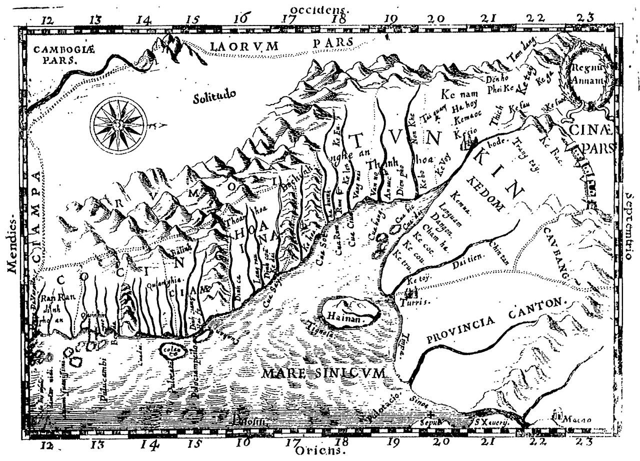
Early Western Map of Tonkin (1651). One of the earliest Western maps showing details of northern and central Vietnam appeared in Father Alexander de Rhodes's Histoire dv royavme de Tvnqvin, published in Rome in 1650. This map is from the French edition, published a year later in Lyon. Oriented with the north to the right, "Regnu Annam" shows the extent of seventeenth-century Vietnam, then divided between two rival dynasties, one in the north and the other in central Vietnam. Remnants of the Cham kingdom, eventually destroyed by the Vietnamese, still exist in the south. To the west, are the highlands occupied by "Rumoi" (upland minority groups, later called "montagnards" by the French). The limited Western knowledge of the interior is illustrated by the large region labeled "Solitudo."
(originally from https://www.loc.gov/rr/asian/guide/guide-southern.html) High-resolution version from The BNF
Licenca
|
To delo je v javni domeni tudi v državah in na območjih, kjer trajajo avtorske pravice za časa avtorjevega življenja in še 70 let ali manj po tem.
| |
| Datoteka je bila prepoznana kot prosta omejitev po avtorskem pravu, vključno z vsemi povezanimi in sorodnimi pravicami. | |
Zgodovina datoteke
Kliknite datum in čas za ogled datoteke, ki je bila takrat naložena.
| Datum in čas | Sličica | Velikost | Uporabnik | Komentar | |
|---|---|---|---|---|---|
| trenutno | 22:28, 20. april 2011 | | 3.024 × 2.179 (1,99 MB) | Dragfyre | cropped to center the map image |
| 13:52, 22. maj 2009 |  | 3.298 × 2.581 (1,4 MB) | DHN | updating high-res version | |
| 14:39, 9. september 2006 |  | 640 × 473 (105 KB) | DHN | Early Western Map of Tonkin (1651). One of the earliest Western maps showing details of northern and central Vietnam appeared in Father Alexander de Rhodes's Histoire dv royavme de Tvnqvin, published in Rome in 1650. This map is from the French edition, |
Uporaba datoteke
Datoteka je del naslednjih 2 strani slovenske Wikipedije (strani drugih projektov niso navedene):
Globalna uporaba datoteke
To datoteko uporabljajo tudi naslednji vikiji:
- Uporaba na ast.wikipedia.org
- Uporaba na azb.wikipedia.org
- Uporaba na az.wikipedia.org
- Uporaba na bn.wikipedia.org
- Uporaba na br.wikipedia.org
- Uporaba na ca.wikipedia.org
- Uporaba na ceb.wikipedia.org
- Uporaba na da.wikipedia.org
- Uporaba na de.wikipedia.org
- Uporaba na en.wikipedia.org
- Uporaba na en.wiktionary.org
- Uporaba na eo.wikipedia.org
- Uporaba na es.wikipedia.org
- Uporaba na fr.wikipedia.org
- Uporaba na gl.wikipedia.org
- Uporaba na id.wikipedia.org
- Uporaba na it.wikipedia.org
- Uporaba na ja.wikipedia.org
- Uporaba na km.wikipedia.org
- Uporaba na ms.wikipedia.org
- Uporaba na no.wikipedia.org
- Uporaba na pl.wikipedia.org
- Uporaba na pt.wikipedia.org
- Uporaba na sv.wikipedia.org
- Uporaba na vi.wikipedia.org