Slika:Oga Peninsula and Hachirogata Akita Japan SRTM.jpg

Velikost tega predogleda: 608 × 600 točk. Druge ločljivosti: 243 × 240 točk | 486 × 480 točk | 681 × 672 točk.
Izvorna datoteka (681 × 672 točk, velikost datoteke: 103 KB, MIME-vrsta: image/jpeg)
Spodaj prikazane informacije so s tamkajšnje opisne strani.
Povzetek
| Opis |
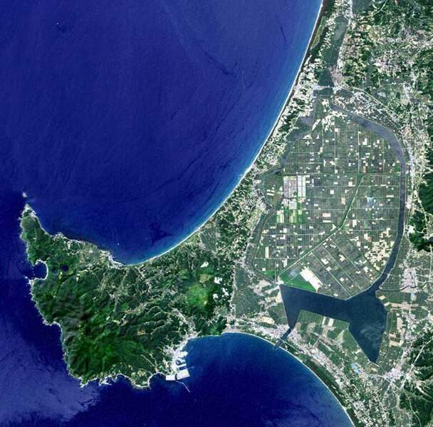
English: Oga Peninsula, Akita, Japan. Hachirōgata is the flat farmland surrounded by water near the base of the peninsula. |
| Datum | |
| Vir | image with high-resolution data from Space Shuttle. |
| Avtor | user:っ |
| Druge različice |
|

Licenca
This image uses high-resolution digital topography data from NASA's Shuttle Radar Topography Mission (SRTM) at JPL-Caltech [1]. It is in the public domain in the United States.
|
 | |
Zgodovina datoteke
Kliknite datum in čas za ogled datoteke, ki je bila takrat naložena.
| Datum in čas | Sličica | Velikost | Uporabnik | Komentar | |
|---|---|---|---|---|---|
| trenutno | 07:50, 12. januar 2005 | | 681 × 672 (103 KB) | っ | Oga Peninsula, Akita, Japan. Landsat image with high-resolution data from Space Shuttle. {{GFDL-Landsat-Kashmir3d}} {{SpaceShuttle}} |
Uporaba datoteke
Datoteka ni del nobene strani slovenske Wikipedije.
Globalna uporaba datoteke
To datoteko uporabljajo tudi naslednji vikiji:
- Uporaba na ar.wikipedia.org
- Uporaba na ca.wikipedia.org
- Uporaba na de.wikipedia.org
- Uporaba na de.wikivoyage.org
- Uporaba na en.wikipedia.org
- Uporaba na es.wikipedia.org
- Uporaba na fi.wikipedia.org
- Uporaba na fr.wikipedia.org
- Uporaba na he.wikipedia.org
- Uporaba na id.wikipedia.org
- Uporaba na ja.wikipedia.org
- Uporaba na ja.wikinews.org
- Uporaba na ko.wikipedia.org
- Uporaba na lt.wikipedia.org
- Uporaba na nl.wikipedia.org
- Uporaba na pl.wikipedia.org
- Uporaba na pt.wikipedia.org
- Uporaba na ru.wikipedia.org
- Uporaba na th.wikipedia.org
- Uporaba na tr.wikipedia.org
- Uporaba na uz.wikipedia.org
- Uporaba na vi.wikipedia.org
- Uporaba na www.wikidata.org
- Uporaba na zh.wikipedia.org