Slika:Macedonia topography-en.svg

Izvorna datoteka (Datoteka SVG, nominalno 920 × 652 pikslov, velikost datoteke: 4,25 MB)
Spodaj prikazane informacije so s tamkajšnje opisne strani.
Povzetek
| Opis |
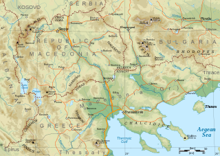
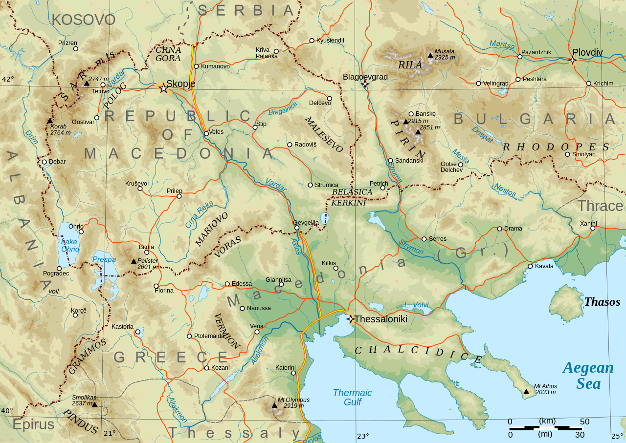
English: Topographical map of Macedonia, i.e. the Republic of North Macedonia, the Greek province of Macedonia, and southwestern Bulgaria. |
| Datum | |
| Vir | lastno delo |
| Avtor | Future Perfect at Sunrise |
| Druge različice |
Izpeljana dela te datoteke: Macedonia topography-He.svg This file version has non-horizontal text labels converted to paths, to ensure correct display with renderers that don't do advanced text layout along paths. If you want to modify or translate this map, please work on the basis of File:Macedonia topography (texts).svg, which has the labels preserved as texts (but will only display correctly in Inkscape).
|

.svg)
Made with GRASS GIS and Inkscape software from public-domain geo data (SRTM3, SWBD, VMAP0). See the excellent tutorials by User:Sting at w:fr:Wikipédia:Atelier graphique/Didacticiels cartographiques/Didacticiels pour la cartographie numérique géoréférencée. Relief levels vectorised and exported to SVG; relief shading is embedded bitmap graphics.
Geographical extent: c. 20.5E to 25.3E, 39.8N to 42.4N; map projection: Lambert conformal conic with standard parallels 40 and 42N, standard meridian 23E. Scale approx. 1:1,600,000 at nominal SVG size.
Licenca
| Jaz, imetnik avtorskih pravic na tem delu, izročam to delo v javno domeno. To velja po vsem svetu. V nekaterih državah to pravno morda ni mogoče. Če je tako, Vsakomur dajem (v okviru zakonskih omejitev) brezpogojno pravico, da gradivo uporablja v kateri koli namen. |
Zgodovina datoteke
Kliknite datum in čas za ogled datoteke, ki je bila takrat naložena.
| Datum in čas | Sličica | Velikost | Uporabnik | Komentar | |
|---|---|---|---|---|---|
| trenutno | 10:29, 31. januar 2009 | | 920 × 652 (4,25 MB) | Future Perfect at Sunrise | some additions and corrections |
| 23:49, 23. januar 2009 |  | 920 × 652 (4,01 MB) | Future Perfect at Sunrise | {{Information |Description={{en|1=Topographical map of geographic Macedonia}} |Source=Own work by uploader |Author=Future Perfect at Sunrise |Date=23 January 2009 |Permission= |other_versions= }} <!--{{ImageUpload|full} |
Uporaba datoteke
Datoteka ni del nobene strani slovenske Wikipedije.
Globalna uporaba datoteke
To datoteko uporabljajo tudi naslednji vikiji:
- Uporaba na ang.wikipedia.org
- Uporaba na ar.wikipedia.org
- Uporaba na ca.wikipedia.org
- Uporaba na el.wikipedia.org
- Uporaba na en.wikipedia.org
- Uporaba na fa.wikipedia.org
- Uporaba na fi.wikipedia.org
- Uporaba na fr.wikipedia.org
- Uporaba na he.wikipedia.org
- Uporaba na id.wikipedia.org
- Uporaba na it.wikipedia.org
- Uporaba na ja.wikipedia.org
- Uporaba na ms.wikipedia.org
- Uporaba na pl.wikipedia.org
- Uporaba na sq.wikipedia.org
- Uporaba na sr.wikipedia.org
- Uporaba na sw.wikipedia.org
- Uporaba na trv.wikipedia.org
- Uporaba na war.wikipedia.org
- Uporaba na zh-yue.wikipedia.org
- Uporaba na zh.wikipedia.org