Slika:Kingdom of Arles 1000.svg

Velikost tega predogleda PNG datoteke SVG: 485 × 340 točk. Druge ločljivosti: 320 × 224 točk | 640 × 449 točk | 1.024 × 718 točk | 1.280 × 897 točk | 2.560 × 1.795 točk.
Izvorna datoteka (Datoteka SVG, nominalno 485 × 340 pikslov, velikost datoteke: 1,25 MB)
Spodaj prikazane informacije so s tamkajšnje opisne strani.
Povzetek
Ta vektorska slika je bila ustvarjena z Inkscape .


.svg)
.svg)
.svg)
.svg)
.svg)


.svg)
.svg)
.svg)


.png)
.png)


.svg)


.svg)

.svg)


.svg)
.svg)
.svg)
.svg)


.svg)
.png)


.svg)


.svg)
.svg)


.svg)


.svg)


.svg)
.svg)
.svg)
.svg)
.svg)
.svg)
.svg)
.svg)
_cropped.svg)
.svg)
.svg)
.svg)
.svg)
.svg)
.svg)
.svg)
.svg)
.svg)
.svg)
.svg)
.svg)
.svg)
.svg)
.svg)
.svg)
.svg)
.svg)
.svg)
.svg)
.svg)
.svg)
.svg)
.svg)
.svg)
.svg)
.svg)
.svg)
.svg)
.svg)
.svg)
.svg)
.svg)
.svg)
.svg)
.svg)
.svg)
.svg)
.svg)
.svg)
.svg)
.svg)
.svg)
.svg)
.svg)
Licenca
Datoteka je objavljena pod licenco Creative Commons Priznanje avtorstva-Deljenje pod enakimi pogoji 4.0 Mednarodno.
- Dovoljeno vam je:
- deljenje – reproducirati, distribuirati in javno priobčevati delo
- predelava – predelati delo
- Pod naslednjimi pogoji:
- priznanje avtorstva – Navesti morate ustrezno avtorstvo, povezavo do licence in morebitne spremembe. To lahko storite na kakršen koli primeren način, vendar ne na način, ki bi nakazoval, da dajalec licence podpira vas ali vašo uporabo dela.
- deljenje pod enakimi pogoji – Če boste to vsebino predelali, preoblikovali ali uporabili kot izhodišče za drugo delo, morate svoj prispevek distribuirati pod enako ali združljivo licenco, kot jo ima izvirnik.
Zgodovina datoteke
Kliknite datum in čas za ogled datoteke, ki je bila takrat naložena.
| Datum in čas | Sličica | Velikost | Uporabnik | Komentar | |
|---|---|---|---|---|---|
| trenutno | 16:41, 23. maj 2016 | | 485 × 340 (1,25 MB) | Alphathon | Corrected status of Bohemia |
| 20:16, 22. maj 2016 |  | 485 × 340 (1,24 MB) | Alphathon | Split Capua from Benevento and removed both from HRE, along with Spoleto | |
| 18:42, 22. maj 2016 |  | 485 × 340 (1,23 MB) | Alphathon | Added Welsh kingdoms/principalities and removed Rügen from the HRE | |
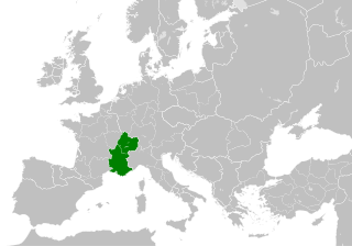
| 17:39, 22. maj 2016 |  | 485 × 340 (1,23 MB) | Alphathon | == {{int:filedesc}} == {{Inkscape}} {{Information |Description={{en|A map of the Kingdom of Arles/Arelat/Burgundy within Europe circa 1000 CE. The main subdivisions of the Byzantine Empire, Holy Roman Empire, Burgundy, France a... |
Uporaba datoteke
Datoteka je del naslednje 1 strani slovenske Wikipedije (strani drugih projektov niso navedene):
Globalna uporaba datoteke
To datoteko uporabljajo tudi naslednji vikiji:
- Uporaba na ast.wikipedia.org
- Uporaba na az.wikipedia.org
- Uporaba na ca.wikipedia.org
- Uporaba na cs.wikipedia.org
- Uporaba na el.wikipedia.org
- Uporaba na en.wikipedia.org
- Uporaba na eo.wikipedia.org
- Uporaba na es.wikipedia.org
- Uporaba na fa.wikipedia.org
- Uporaba na fi.wikipedia.org
- Uporaba na fr.wikipedia.org
- Uporaba na he.wikipedia.org
- Uporaba na hu.wikipedia.org
- Uporaba na id.wikipedia.org
- Uporaba na it.wikipedia.org
- Uporaba na it.wikiquote.org
- Uporaba na ko.wikipedia.org
- Uporaba na lv.wikipedia.org
- Uporaba na mt.wikipedia.org
- Uporaba na pl.wikipedia.org
- Uporaba na ro.wikipedia.org
- Uporaba na th.wikipedia.org
- Uporaba na uk.wikipedia.org
- Uporaba na vi.wikipedia.org
- Uporaba na www.wikidata.org
- Uporaba na zh.wikipedia.org
.svg)