Slika:Great Britain 1789.svg

Velikost tega predogleda PNG datoteke SVG: 450 × 456 točk. Druge ločljivosti: 237 × 240 točk | 474 × 480 točk | 758 × 768 točk | 1.011 × 1.024 točk | 2.021 × 2.048 točk.
Izvorna datoteka (Datoteka SVG, nominalno 450 × 456 pikslov, velikost datoteke: 848 KB)
Spodaj prikazane informacije so s tamkajšnje opisne strani.
Povzetek


.svg)
.svg)
.svg)
.svg)
.svg)


.svg)
.svg)
.svg)


.png)
.png)


.svg)


.svg)

.svg)


.svg)
.svg)
.svg)
.svg)


.svg)
.png)


.svg)


.svg)
.svg)


.svg)


.svg)


.svg)
.svg)
.svg)
.svg)
.svg)
.svg)
.svg)
_cropped.svg)
.svg)
.svg)
.svg)
.svg)
.svg)
.svg)
.svg)
.svg)
.svg)
.svg)
.svg)
.svg)
.svg)
.svg)
.svg)
.svg)
.svg)
.svg)
.svg)
.svg)
.svg)
.svg)
.svg)
.svg)
.svg)
.svg)
.svg)
.svg)
.svg)
.svg)
.svg)
.svg)
.svg)
.svg)
.svg)
.svg)
.svg)
.svg)
.svg)
.svg)
.svg)
.svg)
.svg)
.svg)
.svg)
Licenca
Jaz, imetnik avtorskih pravic na tem delu, ga objavljam pod naslednjo licenco:
Datoteka je objavljena pod licenco Creative Commons Priznanje avtorstva-Deljenje pod enakimi pogoji 3.0 Nedoločena.
- Dovoljeno vam je:
- deljenje – reproducirati, distribuirati in javno priobčevati delo
- predelava – predelati delo
- Pod naslednjimi pogoji:
- priznanje avtorstva – Navesti morate ustrezno avtorstvo, povezavo do licence in morebitne spremembe. To lahko storite na kakršen koli primeren način, vendar ne na način, ki bi nakazoval, da dajalec licence podpira vas ali vašo uporabo dela.
- deljenje pod enakimi pogoji – Če boste to vsebino predelali, preoblikovali ali uporabili kot izhodišče za drugo delo, morate svoj prispevek distribuirati pod enako ali združljivo licenco, kot jo ima izvirnik.
Izvorni dnevniški zapis naložitve
This image is a derivative work of the following images:
- File:Europe_1789.svg licensed with Cc-by-sa-3.0
- 2013-04-14T03:44:26Z Alphathon 450x456 (858577 Bytes) Corrected some errors in northern Italy
- 2013-04-14T01:38:01Z Alphathon 450x456 (853881 Bytes) tweaked again
- 2013-04-14T01:36:10Z Alphathon 450x456 (853881 Bytes) Tweaked Holy Roman Empire border style
- 2013-04-14T01:33:26Z Alphathon 450x456 (853857 Bytes) == {{int:filedesc}} == {{Information |Description={{en|A blank Map of Europe circa 1789. This map also includes a border for the [[:en:Holy Roman Empire|Holy Roman Empire]]. Since there are so many small German states, they h
Uploaded with derivativeFX
Zgodovina datoteke
Kliknite datum in čas za ogled datoteke, ki je bila takrat naložena.
| Datum in čas | Sličica | Velikost | Uporabnik | Komentar | |
|---|---|---|---|---|---|
| trenutno | 18:42, 19. december 2023 | | 450 × 456 (848 KB) | Iktsokh | Cyprus paler grey |
| 13:17, 26. maj 2022 |  | 450 × 456 (846 KB) | Cyygma | Changing pale green to light green (more visible) | |
| 10:08, 17. oktober 2021 |  | 450 × 456 (846 KB) | Fenn-O-maniC | Fixed the Russo-Swedish border to match the Treaty of Åbo of 1743 | |
| 18:20, 5. september 2017 |  | 450 × 456 (857 KB) | Alphathon | Danzig | |
| 17:55, 5. september 2017 |  | 450 × 456 (840 KB) | Alphathon | Added Brunswick-Lüneburg to British domains as it was rules in a personal union | |
| 17:45, 5. september 2017 |  | 450 × 456 (840 KB) | Alphathon | Made Asia paler grey | |
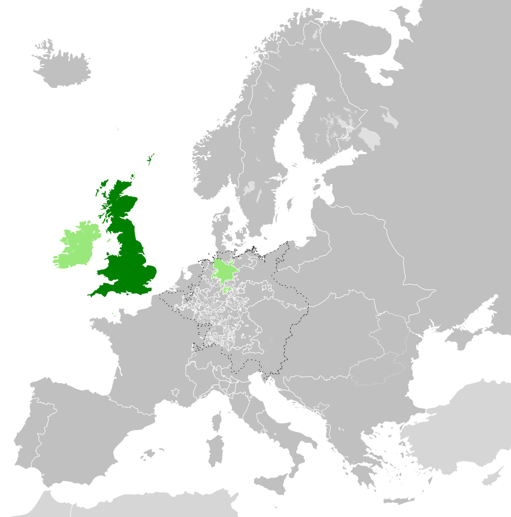
| 17:34, 5. september 2017 |  | 450 × 456 (840 KB) | Alphathon | == {{int:filedesc}} == {{Information |Description={{en|A map of the en:Kingdom of Great Britain circa 1789. Other British-held territories (Ireland, Mann, Channel Islands) are also shown in pale green.}}{{de|Eine Karte des [[:de:Königreich Groß... |
Uporaba datoteke
Datoteka je del naslednje 1 strani slovenske Wikipedije (strani drugih projektov niso navedene):
Globalna uporaba datoteke
To datoteko uporabljajo tudi naslednji vikiji:
- Uporaba na azb.wikipedia.org
- Uporaba na bn.wikipedia.org
- Uporaba na cs.wikipedia.org
- Uporaba na da.wikipedia.org
- Uporaba na de.wikipedia.org
- Uporaba na el.wikipedia.org
- Uporaba na en.wikipedia.org
- Uporaba na es.wikipedia.org
- Uporaba na eu.wikipedia.org
- Uporaba na fi.wikipedia.org
- Uporaba na fr.wikipedia.org
- Uporaba na fy.wikipedia.org
- Uporaba na gv.wikipedia.org
- Uporaba na he.wikipedia.org
- Uporaba na id.wikipedia.org
- Uporaba na it.wikipedia.org
- Uporaba na ja.wikipedia.org
- Uporaba na ko.wikipedia.org
- Uporaba na lo.wikipedia.org
- Uporaba na lv.wikipedia.org
- Uporaba na pt.wikipedia.org
- Uporaba na sco.wikipedia.org
- Uporaba na sk.wikipedia.org
- Uporaba na sq.wikipedia.org
- Uporaba na th.wikipedia.org
- Uporaba na tr.wikipedia.org
- Uporaba na vi.wikipedia.org
- Uporaba na xmf.wikipedia.org
- Uporaba na zh.wikipedia.org