Slika:Egypt sat.png

Velikost tega predogleda: 647 × 600 točk. Druge ločljivosti: 259 × 240 točk | 518 × 480 točk | 828 × 768 točk | 1.265 × 1.173 točk.
Izvorna datoteka (1.265 × 1.173 točk, velikost datoteke: 2,58 MB, MIME-vrsta: image/png)
Spodaj prikazane informacije so s tamkajšnje opisne strani.
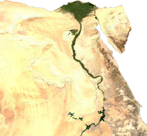
ECW to TIFF to PNG (compression level 9).
| This file is in the public domain, because it was generated by a user, using free sources available at The Map Library.
Note that this does not include the maps in the Global Administrative Areas section of the homepage. |
Zgodovina datoteke
Kliknite datum in čas za ogled datoteke, ki je bila takrat naložena.
| Datum in čas | Sličica | Velikost | Uporabnik | Komentar | |
|---|---|---|---|---|---|
| trenutno | 16:39, 16. julij 2023 | | 1.265 × 1.173 (2,58 MB) | Mododge16 | Removed Israel/Palestine to isolate Egypt |
| 02:20, 26. januar 2020 |  | 1.265 × 1.196 (2,65 MB) | User-duck | Cropped white border using CropTool with precise mode. | |
| 09:58, 27. oktober 2016 |  | 1.382 × 1.241 (2,7 MB) | Milei.vencel | Reverted to version as of 22:18, 22 November 2013 (UTC) | |
| 04:42, 16. avgust 2014 |  | 1.334 × 1.192 (2,44 MB) | Uishaki | clean up | |
| 00:18, 23. november 2013 |  | 1.382 × 1.241 (2,7 MB) | Amrtarek | (Halaib Triangle) | |
| 03:01, 14. julij 2006 |  | 1.334 × 1.192 (2,44 MB) | Unquietwiki | ECW to TIFF to PNG (compression level 9). {{PD-MapLibrary}} |
Uporaba datoteke
Datoteka je del naslednje 1 strani slovenske Wikipedije (strani drugih projektov niso navedene):
Globalna uporaba datoteke
To datoteko uporabljajo tudi naslednji vikiji:
- Uporaba na af.wikipedia.org
- Uporaba na af.wiktionary.org
- Uporaba na an.wikipedia.org
- Uporaba na ar.wikipedia.org
- Uporaba na arz.wikipedia.org
- Uporaba na ba.wikipedia.org
- Uporaba na be-tarask.wikipedia.org
- Uporaba na be.wikipedia.org
- Uporaba na bg.wikipedia.org
- Uporaba na cs.wikipedia.org
- Uporaba na de.wikipedia.org
- Uporaba na en.wikipedia.org
- Uporaba na en.wikibooks.org
- Uporaba na es.wikipedia.org
- Uporaba na fa.wikipedia.org
- Uporaba na fr.wiktionary.org
- Uporaba na hsb.wikipedia.org
- Uporaba na hu.wikipedia.org
- Uporaba na hy.wikipedia.org
- Uporaba na incubator.wikimedia.org
- Uporaba na it.wikipedia.org
- Uporaba na ko.wikipedia.org
- Uporaba na lfn.wikipedia.org
- Uporaba na lt.wikipedia.org
- Uporaba na ml.wikipedia.org
- Uporaba na nl.wikipedia.org
- Uporaba na pt.wikipedia.org
- Uporaba na pt.wikibooks.org
- Uporaba na ro.wikipedia.org
- Uporaba na si.wikipedia.org
- Uporaba na ta.wikipedia.org
- Uporaba na te.wikipedia.org
- Uporaba na tr.wikipedia.org
- Uporaba na tum.wikipedia.org
- Uporaba na uk.wikipedia.org
Oglejte si globalno uporabo te datoteke.