Slika:Devils Tower Darton 1900.jpg
Velikost tega predogleda: 437 × 599 točk. Druge ločljivosti: 175 × 240 točk | 350 × 480 točk | 1.021 × 1.400 točk.
Izvorna datoteka (1.021 × 1.400 točk, velikost datoteke: 1,04 MB, MIME-vrsta: image/jpeg)
Spodaj prikazane informacije so s tamkajšnje opisne strani.
Povzetek
| Opis |
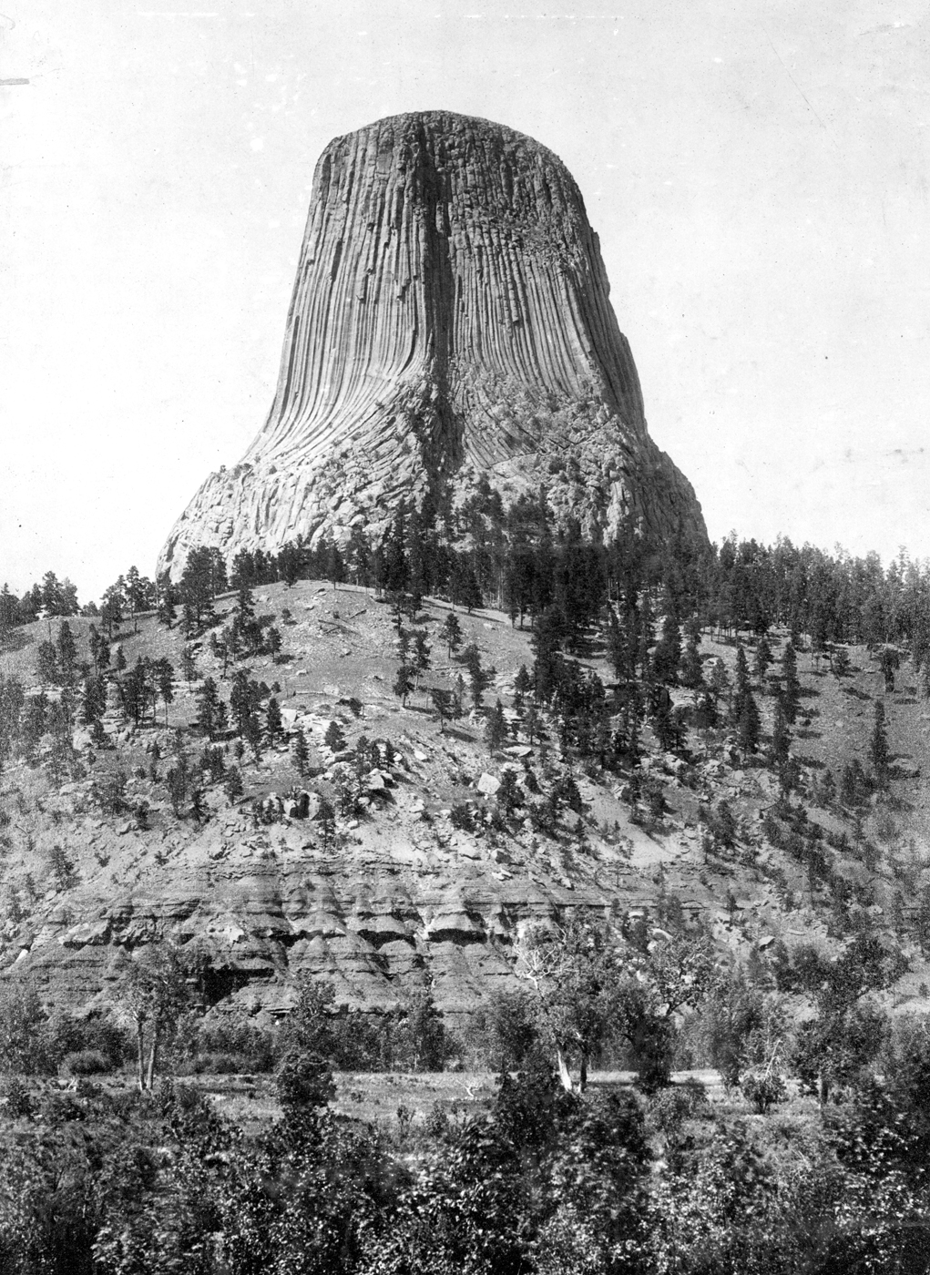
English: Devils Tower, on west bank of Belle Fourche River, south of Hulett. Crook Wyoming. Circa 1900. Plate 17, as Ives Three Color Process, in U.S. Geological Survey. Professional paper 32. 1905, figure 1 in U.S. Geological Survey. Folio 150. 1907. |
| Datum | |
| Vir | U.S. Geological Survey Photographic Library |
| Avtor | Nathaniel H. Darton |
| Lokacija fotoaparata | | Ta in druge slike po lokaciji: OpenStreetMap |
|---|
Licenca
This image is in the public domain in the United States because it only contains materials that originally came from the United States Geological Survey, an agency of the United States Department of the Interior. For more information, see the official USGS copyright policy.
|
Zgodovina datoteke
Kliknite datum in čas za ogled datoteke, ki je bila takrat naložena.
| Datum in čas | Sličica | Velikost | Uporabnik | Komentar | |
|---|---|---|---|---|---|
| trenutno | 05:47, 1. oktober 2010 | | 1.021 × 1.400 (1,04 MB) | Leaflet | {{Information |Description={{en|1=Devils Tower, on west bank of Belle Fourche River, south of Hulett. Crook Wyoming. Circa 1900. Plate 17, as Ives Three Color Process, in U.S. Geological Survey. Professional paper 32. 1905, figure 1 in U.S. Geological Sur |
Uporaba datoteke
Datoteka je del naslednje 1 strani slovenske Wikipedije (strani drugih projektov niso navedene):
Globalna uporaba datoteke
To datoteko uporabljajo tudi naslednji vikiji:
- Uporaba na en.wikipedia.org
- Uporaba na is.wikipedia.org
- Uporaba na ml.wikipedia.org
- Uporaba na nl.wikipedia.org
- Uporaba na pl.wikipedia.org
- Uporaba na zh.wikipedia.org