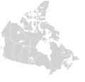
Slika:Canada blank map.svg

Velikost tega predogleda PNG datoteke SVG: 709 × 600 točk. Druge ločljivosti: 284 × 240 točk | 568 × 480 točk | 908 × 768 točk | 1.211 × 1.024 točk | 2.422 × 2.048 točk | 1.114 × 942 točk.
Izvorna datoteka (Datoteka SVG, nominalno 1.114 × 942 pikslov, velikost datoteke: 205 KB)
Zgodovina datoteke
Kliknite datum in čas za ogled datoteke, ki je bila takrat naložena.
| Datum in čas | Sličica | Velikost | Uporabnik | Komentar | |
|---|---|---|---|---|---|
| trenutno | 01:30, 17. november 2020 |  | 1.114 × 942 (205 KB) | MapGrid | Sync with File:Canada_location_map_2_-_lite.svg |
| 13:43, 5. december 2007 |  | 1.304 × 1.263 (113 KB) | Lokal Profil | Cleaned up code | |
| 23:25, 9. avgust 2007 |  | 1.304 × 1.263 (115 KB) | Rfc1394 | {{Information |Description={{en|Blank SVG map of Canada}} Non-contiguous parts of a states/provinces are "grouped" together with the main area of the state/provinces, so any state/provinces can be coloured in completion with one click anywhere on the stat |
Uporaba datoteke
Datoteka je del naslednjih 3 strani slovenske Wikipedije (strani drugih projektov niso navedene):
Globalna uporaba datoteke
To datoteko uporabljajo tudi naslednji vikiji:
- Uporaba na ca.wikipedia.org
- Uporaba na ca.wikimedia.org
- Uporaba na en.wikipedia.org
- Uporaba na fr.wikipedia.org
- Uporaba na os.wikipedia.org
- Uporaba na si.wikipedia.org
- Uporaba na uz.wikipedia.org
