Slika:Thessaly.jpg
Velikost tega predogleda: 665 × 600 točk. Druge ločljivosti: 266 × 240 točk | 532 × 480 točk | 894 × 806 točk.
Izvorna datoteka (894 × 806 točk, velikost datoteke: 1,18 MB, MIME-vrsta: image/jpeg)
Spodaj prikazane informacije so s tamkajšnje opisne strani.
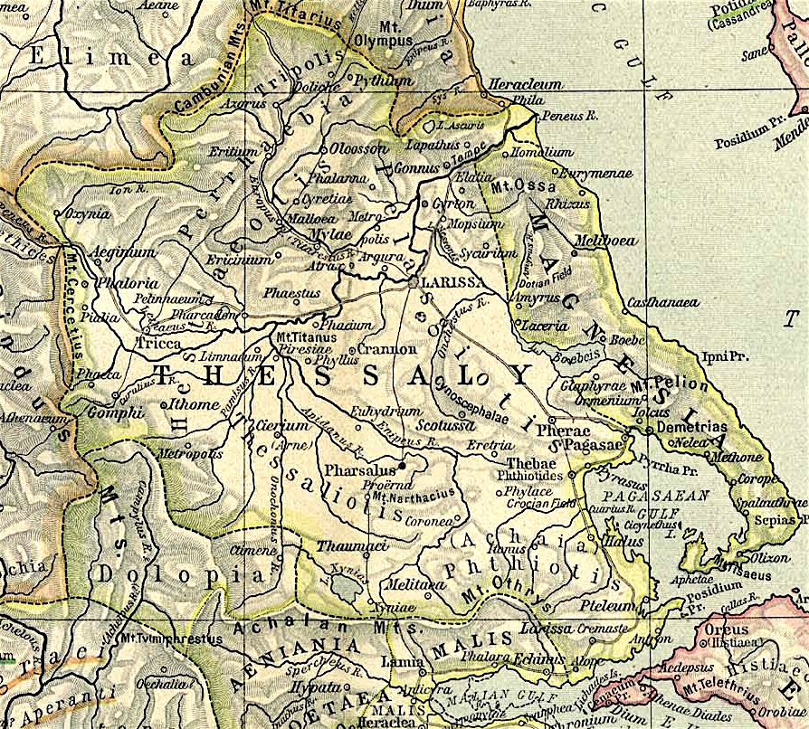
Map of Thessaly, cropped from old public domain map of Greece, from the Perry-Castañeda Library Map Collection, Historical Atlas by William R. Shepherd north, south
Datoteka je objavljena pod licenco Creative Commons Priznanje avtorstva 3.0 Nedoločena.
- Dovoljeno vam je:
- deljenje – reproducirati, distribuirati in javno priobčevati delo
- predelava – predelati delo
- Pod naslednjimi pogoji:
- priznanje avtorstva – Navesti morate ustrezno avtorstvo, povezavo do licence in morebitne spremembe. To lahko storite na kakršen koli primeren način, vendar ne na način, ki bi nakazoval, da dajalec licence podpira vas ali vašo uporabo dela.
Zgodovina datoteke
Kliknite datum in čas za ogled datoteke, ki je bila takrat naložena.
| Datum in čas | Sličica | Velikost | Uporabnik | Komentar | |
|---|---|---|---|---|---|
| trenutno | 14:40, 1. november 2021 | | 894 × 806 (1,18 MB) | Claude Zygiel | Lighter |
| 17:44, 2. oktober 2010 |  | 894 × 806 (680 KB) | Cplakidas | widened to include Magnesia, which was considered part of wider Thessaly | |
| 10:22, 12. december 2006 |  | 769 × 778 (226 KB) | Roke~commonswiki | Map of Thessaly, cropped from old public domain map of Greece, from the Perry-Castañeda Library Map Collection, Historical Atlas by William R. Shepherd [http://www.lib.utexas.edu/maps/historical/shepherd/greece_ancient_n_ref_1926.jpg north], [http://www. |
Uporaba datoteke
Datoteka je del naslednje 1 strani slovenske Wikipedije (strani drugih projektov niso navedene):
Globalna uporaba datoteke
To datoteko uporabljajo tudi naslednji vikiji:
- Uporaba na an.wikipedia.org
- Uporaba na bg.wikipedia.org
- Uporaba na ca.wikipedia.org
- Uporaba na ceb.wikipedia.org
- Uporaba na cs.wikipedia.org
- Uporaba na de.wikipedia.org
- Uporaba na el.wikipedia.org
- Uporaba na en.wikipedia.org
- Thessaly
- Pagasae
- Demetrias
- Phylace (Thessaly)
- Pherae
- Tripolis Larisaia
- Tripolis (Perrhaebia)
- Pythion
- Doliche (Thessaly)
- History of Thessaly
- Palaepharsalus
- Argissa Magoula
- Eurymenae
- Amphrysus
- Gomphi
- Halos (Thessaly)
- Homolium
- Rhizus
- Tricca
- Phalanna
- Perrhaebia
- Pelasgiotis
- Ancient Thessaly
- Pimpleia
- Pelinna
- Pharcadon
- Argos Pelasgikon
- Boebe (Thessaly)
Oglejte si globalno uporabo te datoteke.