Slika:Island of Ireland location map Galway.svg

Velikost tega predogleda PNG datoteke SVG: 481 × 599 točk. Druge ločljivosti: 192 × 240 točk | 385 × 480 točk | 616 × 768 točk | 822 × 1.024 točk | 1.643 × 2.048 točk | 1.450 × 1.807 točk.
Izvorna datoteka (Datoteka SVG, nominalno 1.450 × 1.807 pikslov, velikost datoteke: 642 KB)
Spodaj prikazane informacije so s tamkajšnje opisne strani.
| Opis |
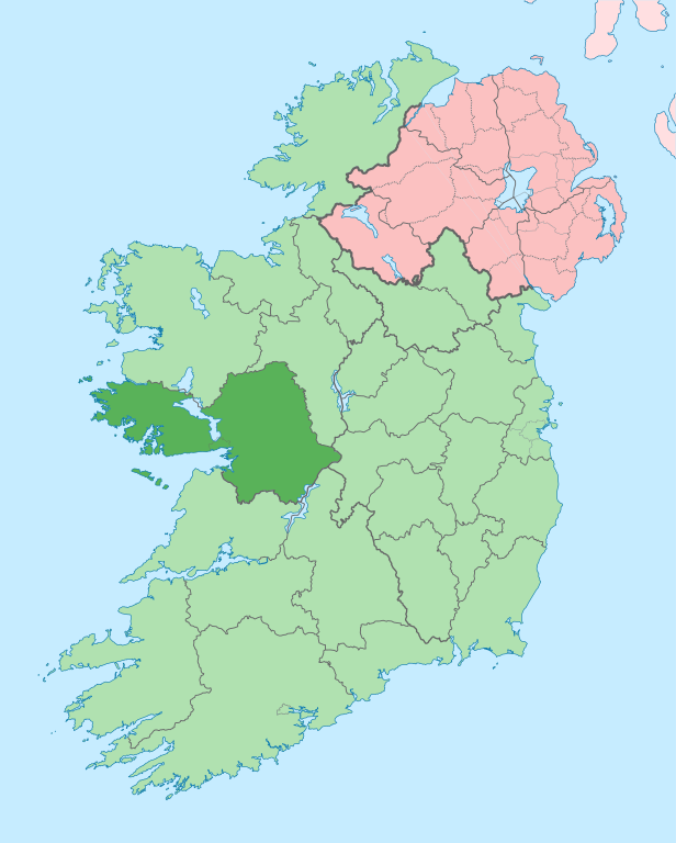
English: The island of Ireland, showing international border between Ireland and Northern Ireland, traditional provinces, traditional counties, and local authority areas in Ireland and Northern Ireland. |
| Datum | (UTC) |
| Vir | |
| Avtor |
|
| Ta slika je digitalno obdelana. Opravljene so bile naslednje spremembe: Coloured in regions with county of article highlighted. Izvirnik je na voljo tukaj: Island of Ireland location map.svg. Spremembe je opravil uporabnik Mabuska.
|
Jaz, imetnik avtorskih pravic na tem delu, ga objavljam pod naslednjo licenco:
Datoteka je objavljena pod licenco Creative Commons Priznanje avtorstva-Deljenje pod enakimi pogoji 3.0 Brez predelav.
- Dovoljeno vam je:
- deljenje – reproducirati, distribuirati in javno priobčevati delo
- predelava – predelati delo
- Pod naslednjimi pogoji:
- priznanje avtorstva – Navesti morate ustrezno avtorstvo, povezavo do licence in morebitne spremembe. To lahko storite na kakršen koli primeren način, vendar ne na način, ki bi nakazoval, da dajalec licence podpira vas ali vašo uporabo dela.
- deljenje pod enakimi pogoji – Če boste to vsebino predelali, preoblikovali ali uporabili kot izhodišče za drugo delo, morate svoj prispevek distribuirati pod enako ali združljivo licenco, kot jo ima izvirnik.
Izvorni dnevniški zapis naložitve
This image is a derivative work of the following images:
- File:Island_of_Ireland_location_map.svg licensed with Cc-by-sa-3.0
- 2010-03-06T20:43:33Z Rannpháirtí anaithnid 1450x1807 (679207 Bytes) Fix incorrectly coloured isands.
- 2010-03-03T22:19:29Z Rannpháirtí anaithnid 1450x1807 (679744 Bytes) {{Information |Description={{de|Positionskarte von [[:de:Irland|Irland]]}} Quadratische Plattkarte, N-S-Streckung 170 %. Geographische Begrenzung der Karte: * N: 55.6° N * S: 51.2° N * W: 11.0° W * O: 5.0° W {{en|Location
Uploaded with derivativeFX
Zgodovina datoteke
Kliknite datum in čas za ogled datoteke, ki je bila takrat naložena.
| Datum in čas | Sličica | Velikost | Uporabnik | Komentar | |
|---|---|---|---|---|---|
| trenutno | 16:00, 28. junij 2020 | | 1.450 × 1.807 (642 KB) | Chipmunkdavis | Per the Local Government Reform Act 2014, joining both Tipperarys and both Waterfords (and removing Limerick City code). Colouring in islands, cleaning up and grouping code to remove stray objects and show Galway and Lough Ree. |
| 02:44, 19. julij 2010 |  | 1.450 × 1.807 (816 KB) | Mabuska | {{Information |Description={{en|The island of Ireland, showing international border between Northern Ireland and Republic of Ireland, traditional provinces, traditional counties, and local authority areas in the Republic of Ireland and Northern Ireland.}} |
Uporaba datoteke
Datoteka je del naslednje 1 strani slovenske Wikipedije (strani drugih projektov niso navedene):
Globalna uporaba datoteke
To datoteko uporabljajo tudi naslednji vikiji:
- Uporaba na ar.wikipedia.org
- Uporaba na ast.wikipedia.org
- Uporaba na bg.wikipedia.org
- Uporaba na ca.wikipedia.org
- Comtat de Galway
- Galway
- Athenry
- An Spidéal
- Tuam
- Kinvara
- Plantilla:Comtat Galway
- Ballinasloe
- Gort
- Loughrea
- Baile na hAbhann
- Casla (Irlanda)
- Béal an Daingin
- Camus (Galway)
- An Cheathrú Rua
- Baile an Chláir
- Bearna
- Ros Muc
- An Fhairche
- Corr na Móna
- Leitir Móir
- Leitir Mealláin
- Maigh Cuilinn
- Ros an Mhíl
- Indreabhán
- Cill Chiaráin
- Cill Rónáin
- Na Forbacha
- Clifden
- New Inn (Galway)
- Aughrim (Galway)
- Baile an Mhuilinn (Galway)
- Uporaba na ceb.wikipedia.org
- Uporaba na cs.wikipedia.org
- Uporaba na en.wikipedia.org
Oglejte si globalno uporabo te datoteke.